blah blah blah
Burns Hill
Length: 1.4 mile loopDifficulty (click for info): Easy
Elevation Gain: 260 feet (+20 feet on descent)
Rating (click for info): 5/10
Elevation: 741'
Prominence: 340'
Driving Directions:
Trailhead and parking area are at the end of Mullen Road in Milford, NH. From the four-way junction on Rt. 13 just south of the interchange with Rt. 101, turn west onto Amory Road. Drive one mile, proceed straight through the first stop sign, and turn left onto Osgood Road at the second. After 1.2 miles, turn right onto a narrow dirt road, Mullen Road, at a hiking sign. Drive between houses 0.2 miles to the parking lot at the end of the road. Click here for a Google map.
Trail map
About the Hike:
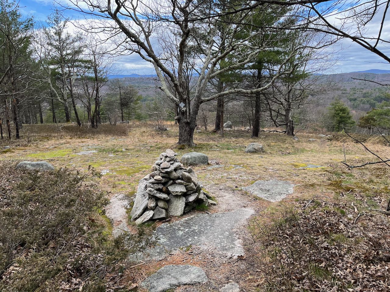
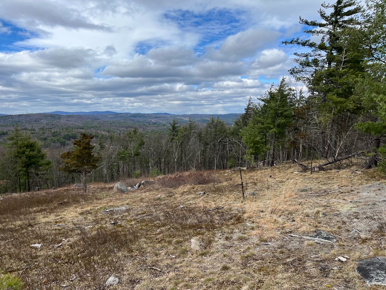
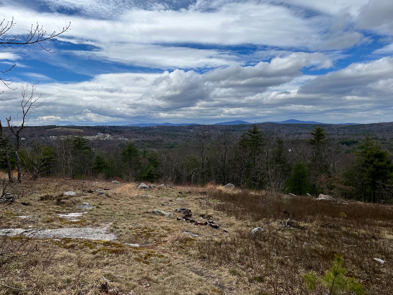
This small summit in the hill country around Milford is part of a little town forest preserving an area of old farmland. The hill with the most name recognition in Milford is Federal Hill, for its fire tower, but Burns Hill is actually a higher elevation. A clearing near its summit opens up lovely views to the west toward the Wapack Range. A nicely built loop trail climbs the steep hillside and circles over the summit.
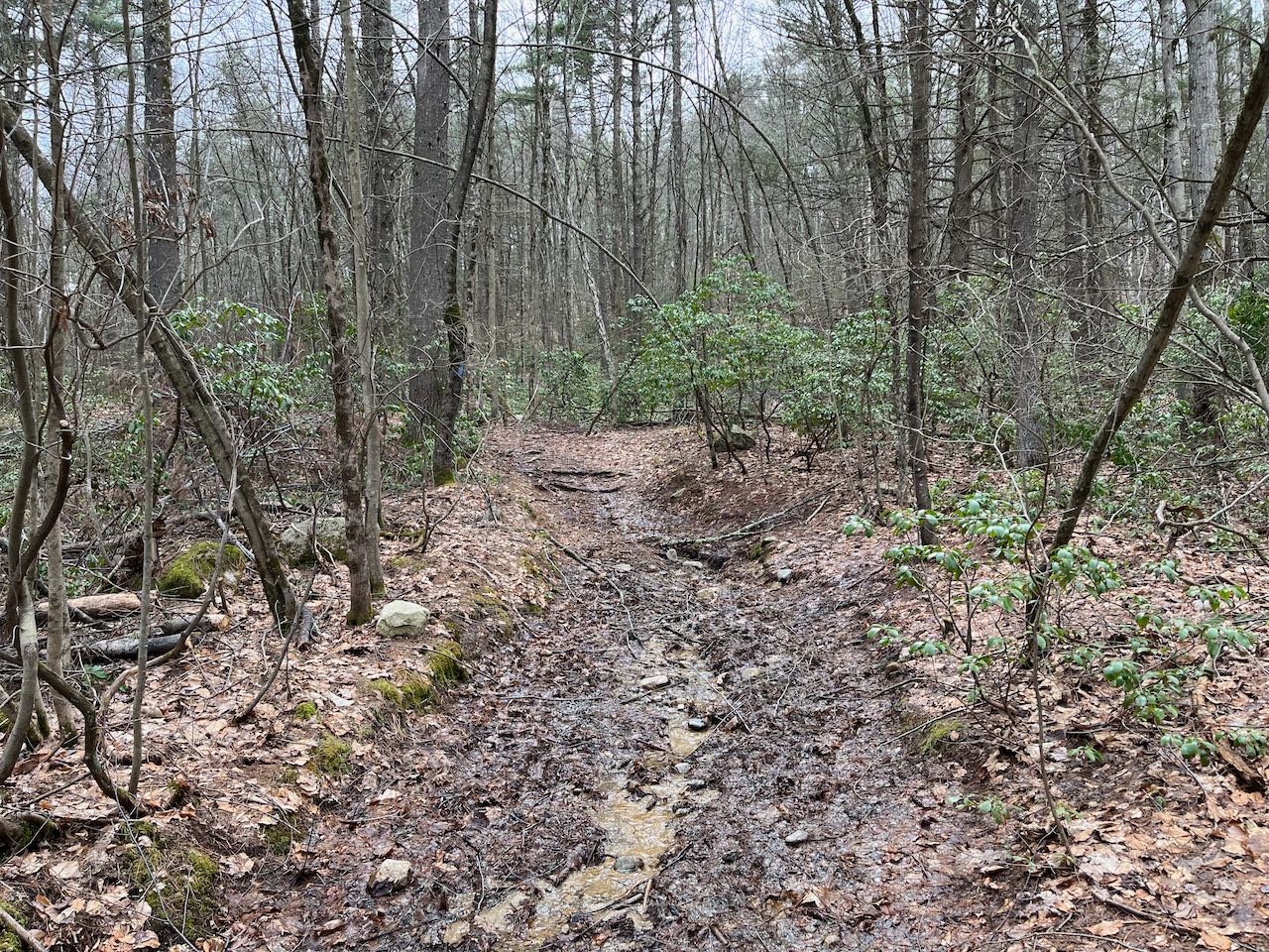
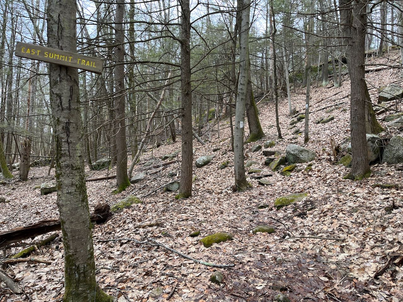
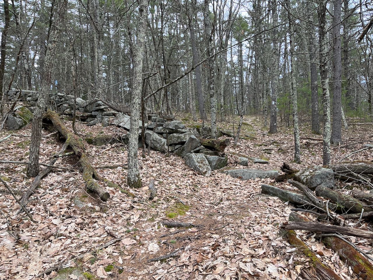
From the parking area, walk into the wide path with white blazes continuing into the woods. At the first junction, bear right onto the blue-blazed trail. Climb up through a grove of mountain laurel and rejoin the white trail after 0.2 miles. Just beyond, turn right onto East Summit Trail. The trail makes a zig-zag up the steep hillside and climbs up through scattered rocks. It follows a stone wall for a bit as the grade lessens, then crosses through a gap in it. It crosses the top of the dome-like hill after a quarter mile, then proceeds straight toward the clearing for a short distance. As the main trail turns left at a cairn, walk ahead into the opening. The wide cleared patch offers a nice view out to the west. All the way to the right, you can catch a glimpse of distant Mt. Kearsarge. Straight ahead, to the right of the cell tower, are Winn Mountain and Rose Mountain in Lyndeborough. To the left of the tower are the two Pack Monadnocks. Next to the left is Temple Mountain, and further over behind a large neighborhood are a few more of the Wapack Range peaks. Continue on the white trail as it descends down the south side of the hill through sparse trees. After 0.2 miles, it swings to the left and follows another stone wall. It swings to the left again around a steeper section, bends back to the right, and drops down to a recently used logging road in another 0.2 miles. Turn left and follow the road across the base of the hill for 0.15 miles back to the junction with the East Summit Trail. Continue back the way you came for a short distance, then bear right to stay on the white trail for some more variety on the way down. Descend through the mountain laurel again and bear left as you approach an open field. In 0.2 miles, you're back at the start of the loop. Bear right back out to the parking lot.
Printable directions page